Science Objectives
The science objective of the MicroCarb mission is to monitor and characterize CO2 surface fluxes, that is, the exchanges between sources (natural or anthropogenic) and sinks (atmosphere, ocean, land and vegetation).
Annual global fluxes of CO2 represent a quantity of the order of 200 gigatons of carbon. Anthropogenic emissions bring an additional quantity of 10 gigatons, with the effect of disrupting the natural balance. This surplus is half absorbed by vegetation, land and the oceans, the other half being of the reason for the increase in the atmospheric concentration of greenhouse gases (mainly CO2), driving climate change.
MicroCarb will also imeasure atmospheric methane, the second most important anthropogenic greenhouse gas whose emissions are poorly known.
A better assessment of carbon fluxes is necessary to:
- Improve our understanding of the mechanisms governing the exchanges between sources and sinks, their seasonal variability, and their evolution in response to climate change,
- Identify the parameters that control carbon exchanges
- Validate and improve (by reducing their uncertainty) the models simulating the carbon cycle
In addition, MicroCarb aims to be a precursor of a future operational system able to accurately monitor global fossil emissions.
Understanding the carbon cycle is important since it can help us to anticipate its evolution according to possible climate change scenarios (the IPCC has already stated that this evolution will be negative, i.e., uptake will continue to drop as temperature rises).
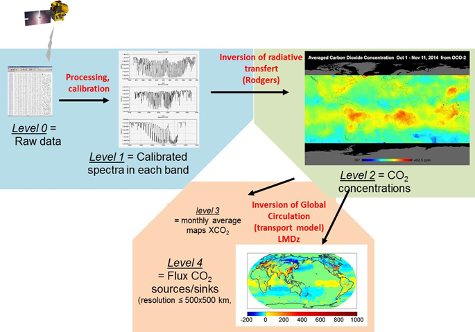
Fluxes cannot be directly measured but must be calculated from measurements of atmospheric concentration made by satellites and from the inversion of these data by mean of an atmospheric transport model. The surface fluxes thus obtained (called level 4 products) are global fluxes taking into account natural and anthropogenic fluxes.
Values of CO2 concentrations need to be measured with high precision, of the order of 1 ppm (to be compared with the CO2 concentration of 400 ppm) to be able to estimate gradients which amounts to a few ppm. Spatial coverage and the repeat cycle of measurements are also important in the process of inversion, which is why space-based observations are so valuable compared to a ground network that is difficult to deploy worldwide.
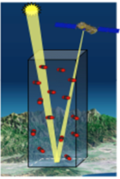
Concentration values of gases are themselves computed from measurements of the atmospheric spectrum in some wavelengths specific to these gases. CO2 (and methane) is a gas with absorption lines in the infrared (at 1.6 and 2.0 µm); solar radiation reflected by Earth then goes through the atmosphere twice before reaching the satellite and carries the signature of these molecules. The concentration is deduced from the depth of these absorptions in the measured spectra. Besides these two CO2 absorption lines, MicroCarb will also acquire spectra in lines characteristic of O2 (at 0.76 and 1.27 µm) in order to be able to normalize CO2 concentration measurements by factoring in atmospheric pressure and the effect of dispersive elements like clouds and aerosols.
MicroCarb will then measure the spectral radiance of the solar radiation reflected by Earth, at nadir on land surfaces and at glint on the oceans. These spectral radiance measurements will be converted into column integrated concentrations of CO2 by applying a mathematical inversion of the spectrum.
Data processing flow
Atmospheric measurement principle
Mission
The objective of the MicroCarb mission being to measure the CO2 concentration with extreme precision (of the order of 1 ppm, which is 0.3 %), the observed luminance spectrum has to be of very high quality. This means that high values are required for spectral resolution and the signal-to-noise ratio. For a dispersive spectrometer concept as implemented, the required resolving power is between 25,000 and 42,000.
Sampling mission
The transport model used for reconstructing fluxes has a spatial resolution of 2.5°x 3.75 ° (or 250 x 400 km at equator). This resolution can regionally be improved down to 1°x1°. The model is able to handle four dimensions, that is, the time dimension in addition to the three spatial dimensions: and then assimilate data spread over time. MicroCarb is thus sized sample every cell of this model in a minimum of time (one week) but not to provide a regular coverage of every single point of the globe.
It will nevertheless be able, as part of an exploratory programme, to perform spectral imaging over specific areas (typically urban areas) with a ground resolution of 2 x 2 km², instead of the nominal resolution of 30 km².
Varied pointing mode
Nadir scanning
Over land surfaces, the satellite will perform acquisition at nadir. A scan mechanism will make it possible to point the line of sight on either side of the satellite track with an amplitude of ± 200 km, thus increasing acquisition of uncorrelated measurements.
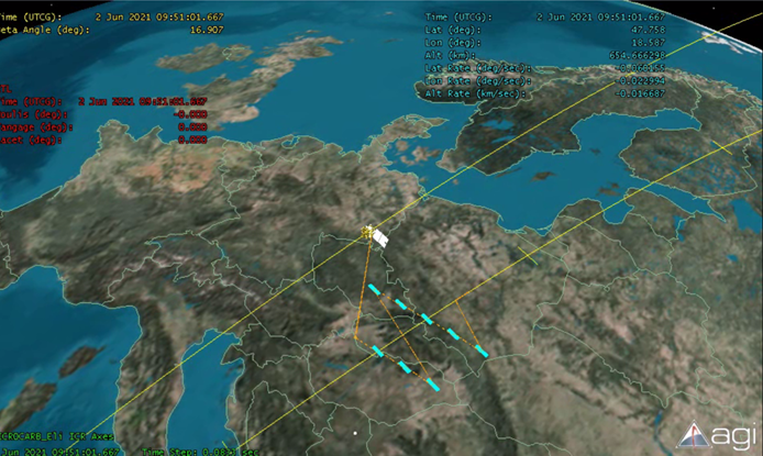
Illustration of the scanning mode at nadir
Solar glint tracking
Over oceans, water being dark in the spectral domain of the near infrared and thus not reflecting sunlight, MicroCarb will aim at glint, which is the reflection spot of the sun, instead of nadir. This glint-tracking capacity ensures a sufficient level of flux coming into the instrument to be able to measure the concentration of atmospheric CO2 over oceans.
Distribution between nadir and glint measurements (example)
The figure above shows a possible distribution between glint and nadir modes. Orbits in blue are in glint mode (orbits mainly over oceans), while orbits in yellow are in nadir mode. It is also possible to have part on an orbit in nadir pointing mode and another part in glint. Nadir pointing is achieved by the satellite along the pitch axis and using the scan mechanism along the roll axis.
Target pointing
The last observation mode consists in permanent acquisitions on a fixed target. This mode is in particular intended to allow verification of the accuracy of concentration measurements in comparison with measurements performed by ground stations in the TCCON network.
This operative mode will also be used for high-resolution mapping over specific areas covering tens of square kilometres.
In this mode, movement around the pitch axis is provided by the satellite, while movement around the roll axis is provided by the instrument’s scan mechanism.
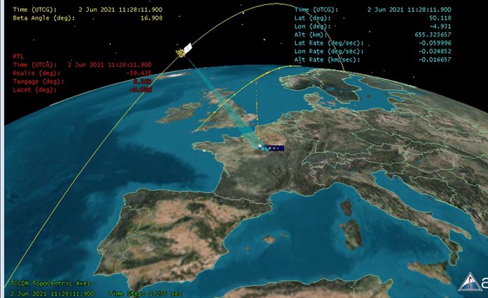
Illustration of target pointing
Sun pointing
A Sun-pointing mode will enable the instrument’s spectral calibration.
Sun-synchronous orbit
The choice of orbit is dictated by the science objectives while taking into account optimization for piggyback launch opportunities and space debris mitigation. The selected orbit is a Sun-synchronous orbit with an altitude of 650 km and a local time (descending node) at 10:30. The choice of the local crossing time optimizes the solar flux (to reduce the reflection angle). The choice of the altitude optimizes the uniformity of coverage out to a range of one week. The system remains compatible with a change of local time (1:30 p.m.).
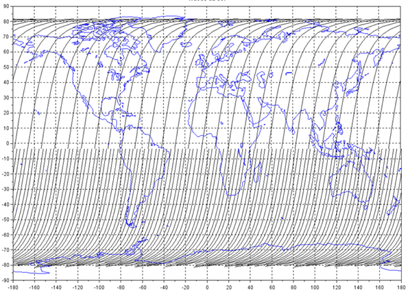
Coverage obtained on a cycle of 21 days and a sub-cycle of 7 days
