DROWN BY THE RIVER …
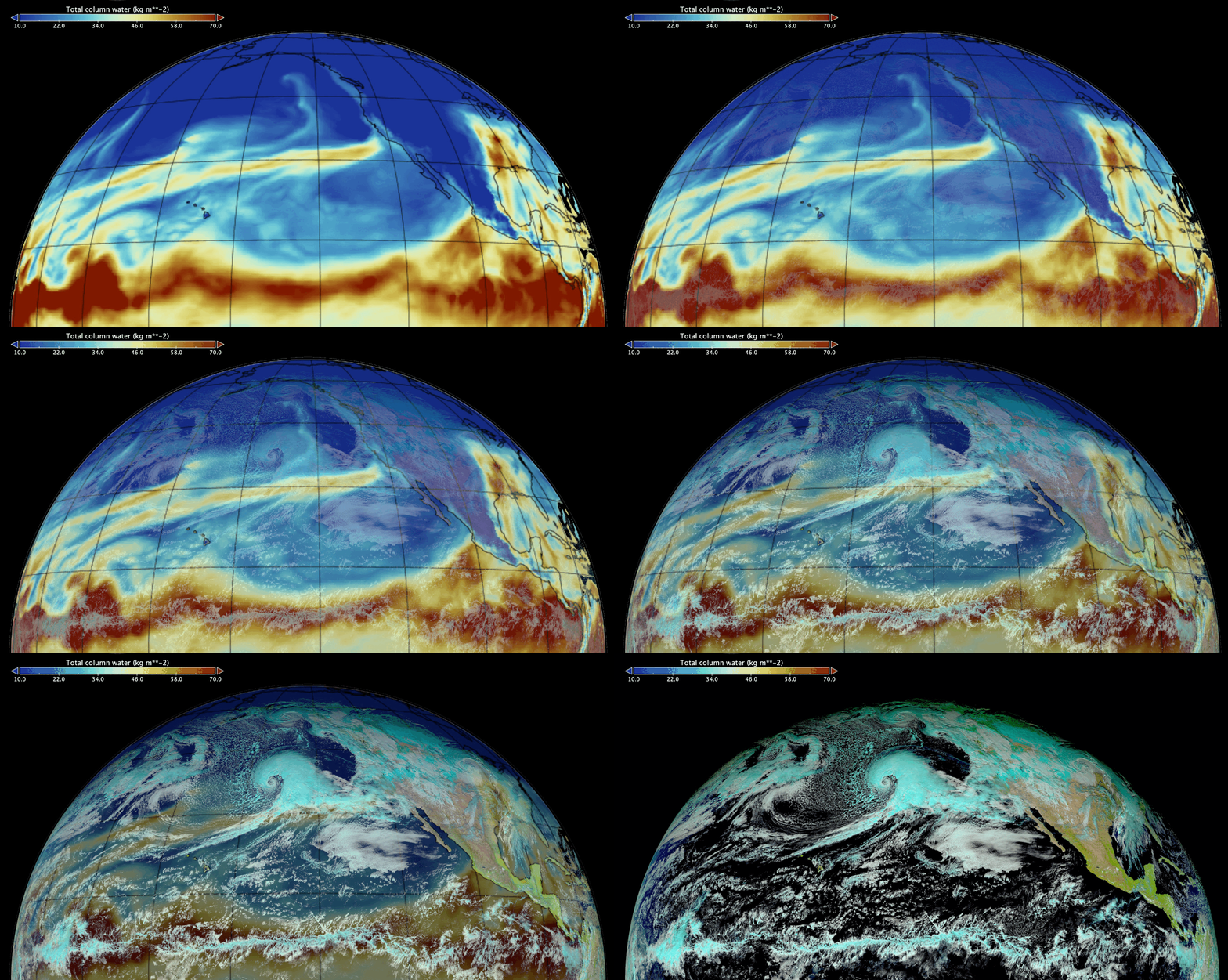
In late December 2022 and for most of January 2023 an atmospheric river (yellow plume over North Pacific Ocean) transported vast amount of water vapor from the tropical belt across Pacific up to west coast of North America, leading to record precipitations in California especially when it combined with the extreme event that developed on the 3rd and 4th of January.
This so-called bomb cyclone, also referred to as an “extra-tropical cyclone”, most likely boosted by the atmospheric river unleashed deluges over an already drenched California. Geostationary satellite observations are particularly well suited to monitor the development of such storms but precipitations and snow falls are better observed by microwave sensors such as those carried by satellites of the Global Precipitation Mission (GPM) constellation. Eventually the mountains of Sierra Nevada and Eastern Utah also received unprecedented amount of snow … likely a more enjoyable ending for those snow powder fans in Utah than for those being drown by the atmospheric river in California.
The bomb cyclone developed extremely rapidly between the 3rd and 4th of January under the conditions of a massive depression located less than a thousand kilometers from the coast which peaked on January 4th as illustrated by the surface pressure and wind field illustrated below (source : https://earth.nullschool.net) .
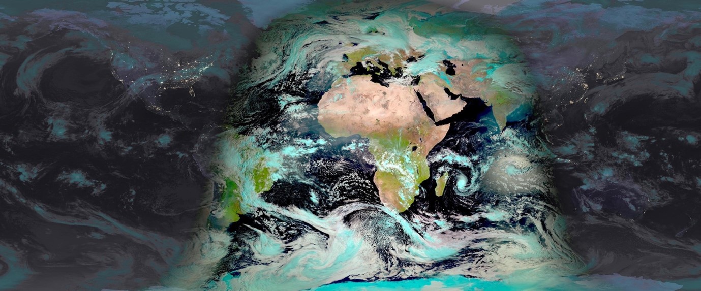
The ring of geostationary sensors and in particular ABI on the GOES-18 satellite (from GOES-West series) offers a dynamic view of the bomb cyclone as it’s forming and developing from January 2nd to January 5th. The animation below also illustrates the successive storms that succeeded each other and poured massive amount of rainfall over California during the period from 16 December 2022 to 04 January 2023.
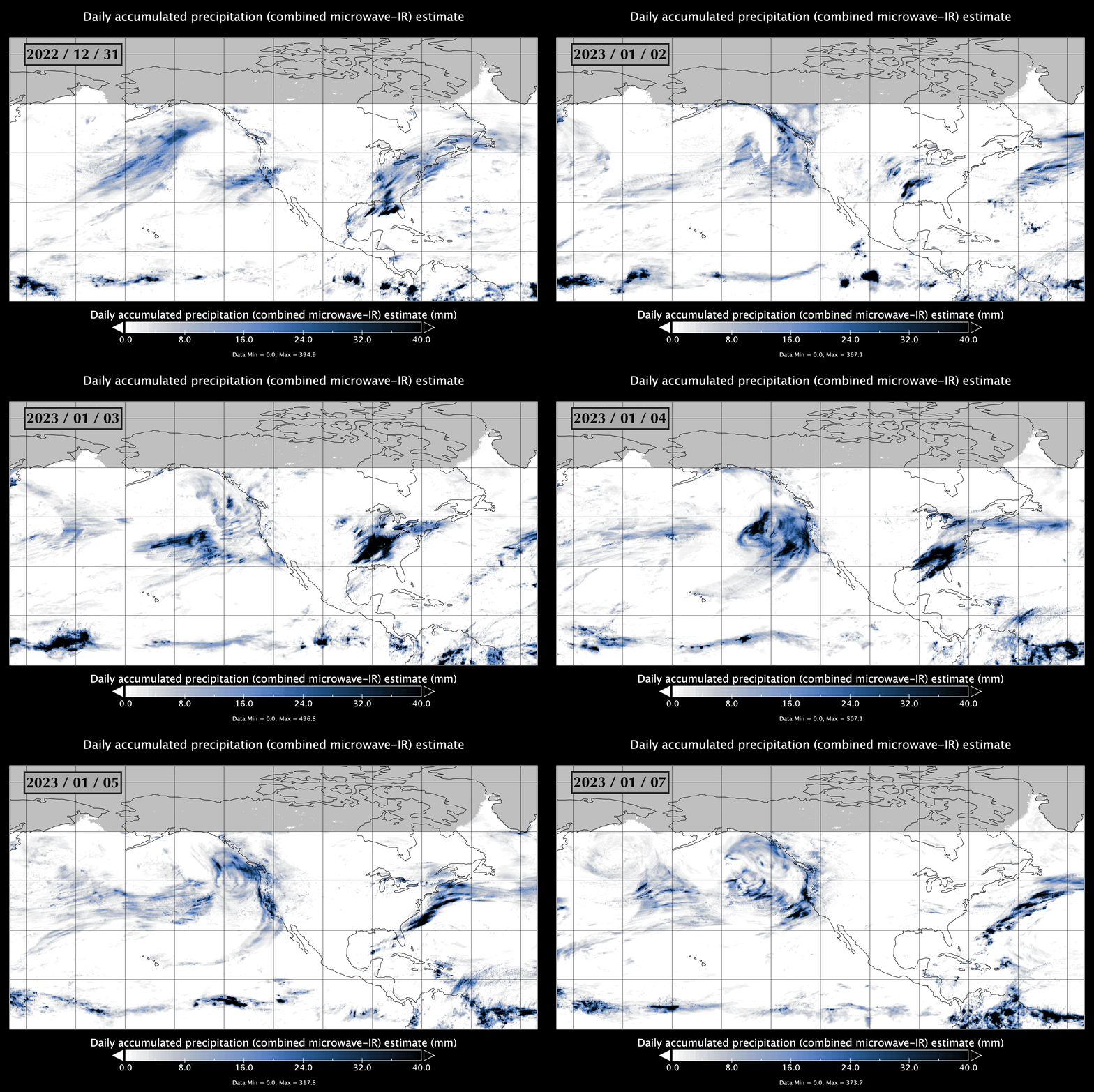
The heavy precipitation occurring as the storms and the atmospheric river were interacting to create those extreme events have been captured by the Global Precipitation Mission constellation. The IMERG product derived from GPM observations, and illustrated below for the period of Dec 31, 2022 to Jan 7 2023, leverage a combination of Infrared and Microwave observations to produce high-quality estimate of precipitation. The heavy rainfall produced by the bomb cyclone on January 4th is clearly visible on the animation and stands out even in this remarkable series of storms.
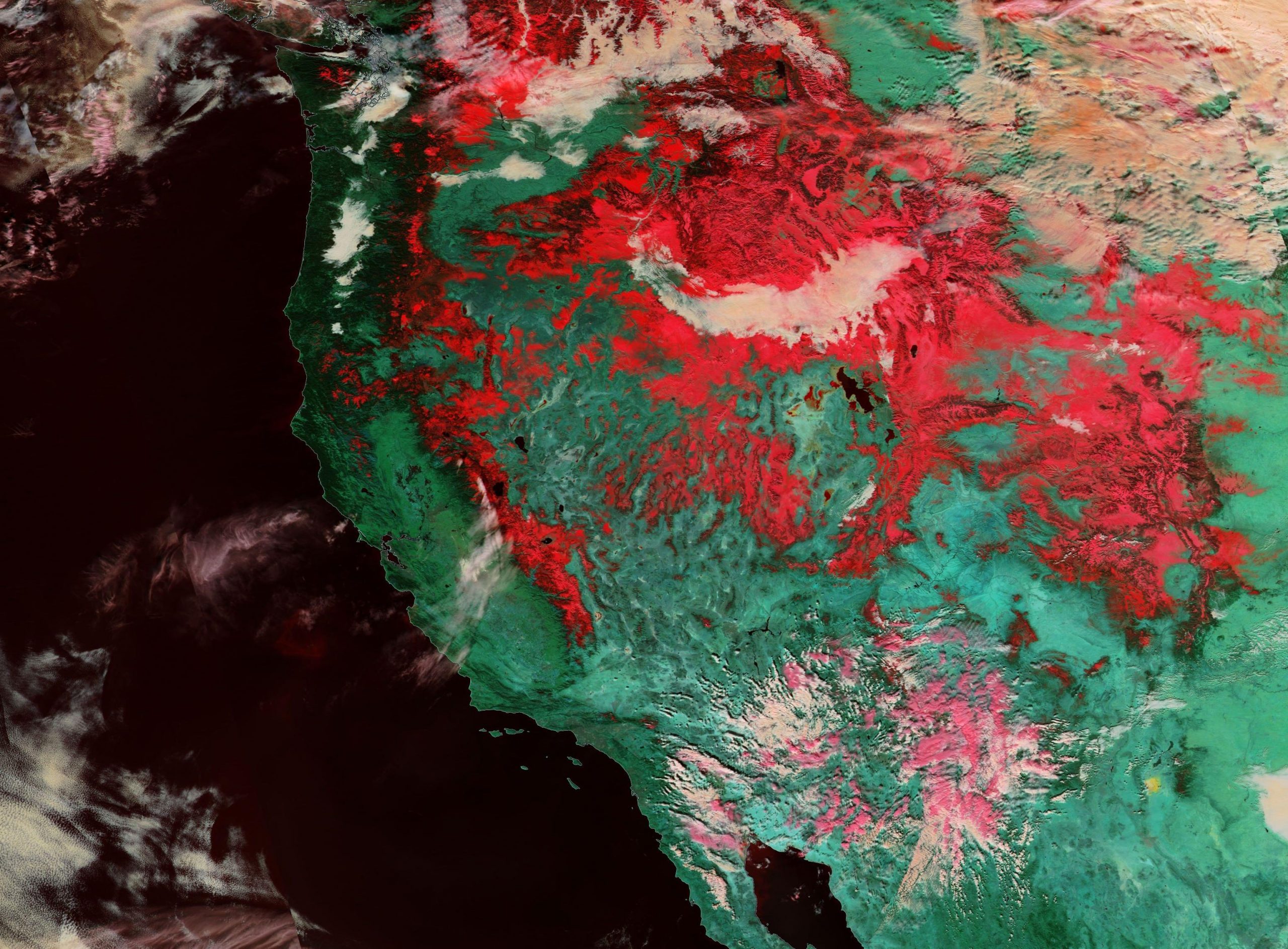
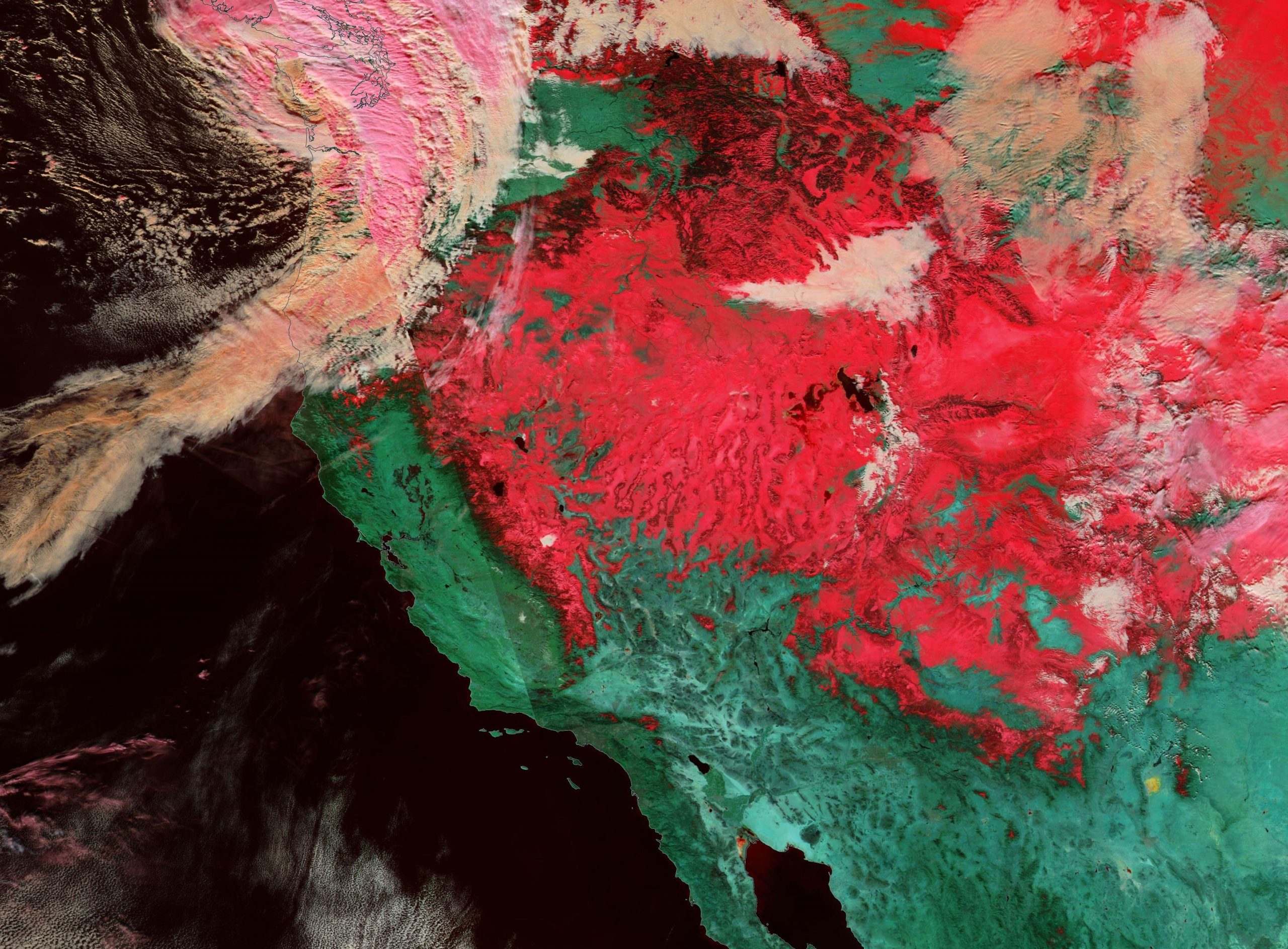
Eventually, those heavy precipitations also probably contributed to some people enjoying snow powder in the Sierra Nevada and Uinta Mountains in Utah. The VIIRS instrument on Suomi NPP provides a striking illustration of the vast snow cover that had accumulated on January 22, 2023 compared to the same period a year ago on January 21, 2022. The false color composite image uses shortwave infrared bands that render snow covered land in bright reddish colors.
