Highlights

Release of CALIPSO V4.20 Lidar Level 2 products October 2018

The CALIPSO mission team, in collaboration with the Atmospheric Science Data Center (ASDC) at NASA Langley Research Center and AERIS/ICARE Data and Services Center, announces the release of an update to the standard Level 2 lidar data products: CAL_LID_L2_01kmCLay-Standard-V4-20 CAL_LID_L2_333mMLay-Standard-V4-20 CAL_LID_L2_05kmMLay-Standard-V4-20 CAL_LID_L2_05kmALay-Standard-V4-20 CAL_LID_L2_05kmCLay-Standard-V4-20 CAL_LID_L2_05kmAPro-Standard-V4-20 CAL_LID_L2_05kmCPro-Standard-V4-20 CAL_LID_L2_VFM-Standard-V4-20 The V4.20 CALIOP Level 2 products contain new laser […]


24.10.2018

CALIPSO orbit change September 2018

On September 13, 2018 CALIPSO will begin lowering its orbit from 705 km to 688 km to resume formation flying with CloudSat. The sequence of maneuvers is expected to take about a week and the payload instruments will be turned off (Cloud-Aerosol Lidar with Orthogonal Polarization (CALIOP), Imaging Infrared Radiometer (IIR), and Wide Field Camera […]

11.09.2018

Release of CALIPSO V1-00 Lidar Level-3 Ice Cloud product July 2018

The Atmospheric Science Data Center (ASDC) at NASA Langley Research Center in collaboration with the CALIPSO mission team announces the release of a new CALIOP Level 3 Ice Cloud Product: CAL_LID_L3_Ice_Cloud-Standard-V1-00 The CALIOP Level-3 Ice Cloud monthly product reports global distributions of ice cloud extinction coefficients and ice water content histograms on a uniform spatial […]

06.07.2018

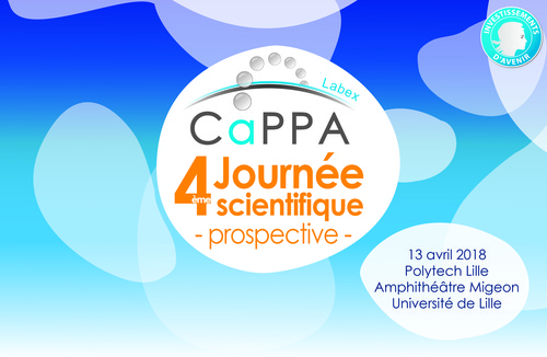
4e Journée Scientifique et Prospective du Labex CaPPA – 13 avril 2018 4th Science Day and Outlook of the Labex CaPPA – April 13, 2018

La Journée Scientifique du Labex CaPPA est organisée tous les ans à destination des laboratoires du Labex. Elle est l’occasion de discuter et échanger au sujet des avancées scientifiques des différents groupes de travail. Cette année, une discussion prospective est prévue pour définir les lignes directrices de la suite du projet. Toute la communauté scientifique […]

22.03.2018

2nd announcement 3rd International A-Train Symposium 18-21 April 2017, Pasadena Convention Center, California

The 705-km Afternoon (A-Train) Satellite Constellation brings together a rich array of instruments to better understand Earth’s changing climate and environment. The 3rd International Symposium on the A-Train Satellite Constellation is an opportunity to learn more about the evolving capabilities of the A-Train system, and to engage other colleagues with similar interests. To see the […]

17.10.2017

CALIPSO IIR Level-1 V2-00 Release Announcement July 2017

The Atmospheric Science Data Center (ASDC) at NASA Langley Research Center in collaboration with the CALIPSO mission announces the release of the following data product: CAL_IIR_L1- Standard-V2-00 Version 2.00 of the IIR Level-1 product is the first major revision since the initial release in 2006. The calibration procedure has been adjusted to reduce known small […]

26.07.2017

Public release of Megha-Tropiques Surface Accumulated Rainfall – May 2017 – Update March 2018

Update of previous highlight posted in May 2017: The TAPEER-BRAIN product is now available until December 14, 2017. Please note that this product is available in the MULTI_SENSOR section of the archive. We are pleased to announce the release of the daily cumulated surface rainfall products and associated uncertainties. This so-called TAPEER-BRAIN product is available […]

16.06.2017

POLDER/PARASOL full reprocessing and new multi-sensor synergistic products – April 2017

At the end of the PARASOL mission, CNES completed the final reprocessing of Level-1 data in 2014. ICARE completed the reprocessing of the PARASOL Level-2 and Level-3 products in 2015, using revised science codes as well as new codes provided by the French science team at LOA (University of Lille). In addition to the HDF5 […]

11.04.2017

Journée Thématique du Programme National de Télédétection Spatiale “Observation et modélisation de structures 3D des enveloppes superficielles” 16 mars 2017, CNES, Paris

Le Programme National de Télédétection Spatiale organise le 16 mars 2017 une journée thématique consacrée à “Observation et modélisation de structures 3D des enveloppes superficielles” dans le but de favoriser les échanges entre chercheurs sur cette thématique pluridisciplinaire prometteuse. Cette journée thématique du PNTS se déroulera le 16 mars 2017 à Paris de 9h00 à […]

03.02.2017

Search